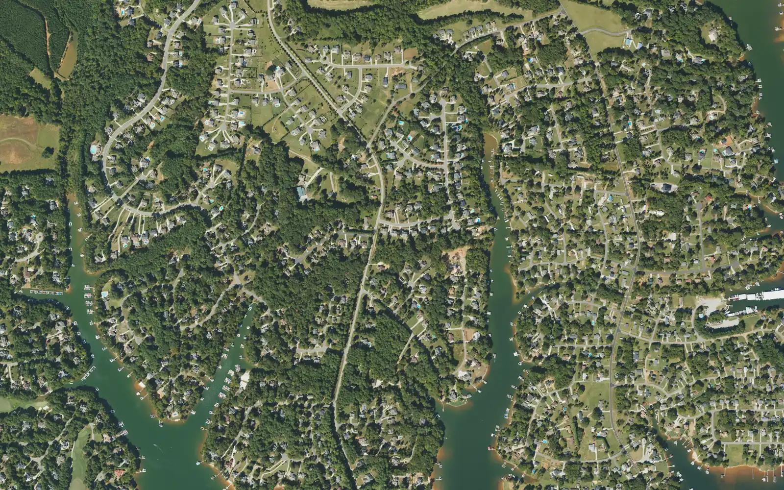
The Brawley School Road peninsula runs west of I-77 into Lake Norman, ZIP code 28117. It is zoned for Iredell-Statesville schools and Lake Norman High.
Last checked Oct. 11, 2026. Sources: the Town of Mooresville’s Mooresville Tomorrow 2040 plan, OpenStreetMap place names and store listings, Iredell-Statesville Schools’ zone finder, the N.C. Department of Public Instruction’s 2025-26 accountability data, the U.S. Census Bureau’s geocoder and Zillow Research.
Brawley School Road leaves I-77 at Exit 35 and runs west and then south down a long peninsula between arms of Lake Norman, with subdivisions on coves on both sides. The town’s comprehensive plan names the Brawley School Road corridor among the commercial strips it wants to rework into walkable centers, and lists the road’s widening among current projects. OpenStreetMap marks Mayhew, a named place, on the road partway down the peninsula. The addresses are Mooresville, ZIP code 28117, but most of the peninsula is outside the town limits.
What this means for you
- Zoned high school: Lake Norman High, 68.1% of tests at grade level in 2025-26. Check an address with the Iredell-Statesville zone finder.
- Home value: $631,168 in ZIP code 28117 in August 2026, according to the Zillow Home Value Index.
- Nearest I-77 exit: Exit 35 at Brawley School Road, about 5 miles by road from the middle of the peninsula.
Part of our Mooresville neighborhoods guide.
Where it is
This guide covers the road and the neighborhoods off it west of I-77, from the shopping centers near the interchange down the peninsula toward its tip. Lake Norman is on both sides, and side roads such as McKendree Road run out to the coves. All of it is in ZIP code 28117.
Town or county? All five points we checked on the peninsula, from Malibu Road to Lake Mist Drive, were in unincorporated Iredell County on the Census Bureau’s geocoder. County residents do not pay the Town of Mooresville’s 48.36-cent tax rate and do not get town trash pickup; check a parcel in Iredell County’s Online Tax Services and see our property tax guide.
Schools
The peninsula is in Iredell-Statesville Schools, the county district, not the Mooresville Graded School District. Scores are the share of state tests at grade level or above in 2025-26, from the state’s accountability data.
| Level | School | 2025-26 at grade level | Growth |
|---|---|---|---|
| Elementary | Woodland Heights Elementary, 288 Forest Lake Blvd. | 84.4% | Exceeded |
| Elementary, east end | Coddle Creek Elementary, 141 Frank’s Crossing Loop | 68.4% | Not met |
| Middle | Woodland Heights Middle, 272 Forest Lake Blvd. | 70.0% | Exceeded |
| High | Lake Norman High, 186 Doolie Road | 68.1% | Met |
In the district’s zone finder, four of our five points were zoned for Woodland Heights Elementary; the point on Malibu Road, nearest I-77, was zoned for Coddle Creek Elementary. All five were zoned for Woodland Heights Middle and Lake Norman High. The Brawley School, 132 Swift Arrow Drive, a middle school where 88.6% of tests were at grade level, did not come up as the zoned school at any point we checked; ask the district how it fills seats. More in our schools guide.
Home values
Zillow publishes no figure for the peninsula. The Zillow Home Value Index is a modeled typical value for the middle third of homes, not a sale price.
| Area | August 2026 | August 2025 | Change |
|---|---|---|---|
| ZIP code 28117 | $631,168 | $631,349 | 0.0% |
| Town of Mooresville, for comparison | $478,099 | $479,383 | -0.3% |
ZIP code 28117 covers the lake side of Mooresville west of I-77, and its typical value is about $228,000 above ZIP code 28115’s. Trends are on our home prices page.
Parks and trails
- Hager Creek Access Area, 788 McKendree Road, on Lake Norman, is listed on OpenStreetMap.
- Hope Park, 170 Joe Knox Blvd., near the I-77 end: 2 acres with a splash pad and a playground, from the town’s parks list.
- Mooresville Public Library West Branch, 614 Brawley School Road, on OpenStreetMap.
The town’s larger parks, such as Mazeppa and Cornelius Road parks, are east of I-77; see our parks and trails guide.
Getting around
- I-77: Exit 35 at Brawley School Road is about 5 miles by road from the middle of the peninsula; Exit 36 at N.C. 150 is about 4.4 miles.
- Downtown Mooresville: about 7.8 miles by road.
- Charlotte Douglas International Airport: about 35 miles by road.
- Road work: NCDOT is widening Brawley School Road east of I-77, from Exit 35 to U.S. 21; see our road construction guide.
- Buses: the ICATS Mooresville Main’s stop list names no stop on the peninsula; booked van trips cost $1, 704-873-9393.
Distances were measured with the OSRM routing engine on OpenStreetMap roads. They are distances, not drive times.
Groceries and everyday stores
From OpenStreetMap: Food Lion, 1088 Brawley School Road, and Walgreens, 1114 Brawley School Road, on the peninsula, and Publix, 631 Brawley School Road, near the I-77 end.
Frequently asked questions
Is Brawley School Road in Mooresville town limits?
Mostly not. Every point we checked on the peninsula with the Census Bureau’s geocoder was in unincorporated Iredell County, though the addresses are Mooresville, ZIP code 28117.
What schools serve the Brawley School Road peninsula?
It is in Iredell-Statesville Schools, not the Mooresville Graded district. The points we checked were zoned for Woodland Heights Elementary and Middle and Lake Norman High; the east end near I-77 was zoned for Coddle Creek Elementary.
What is the typical home value on Brawley School Road?
Zillow publishes no figure for the peninsula. Its typical value for ZIP code 28117 was $631,168 in August 2026, a modeled estimate, not a sale price.
Is Brawley School Road being widened?
Yes, east of I-77. NCDOT’s $51.1 million widening from Exit 35 to U.S. 21 began in June 2024 and was expected to take about three years.
Have your say