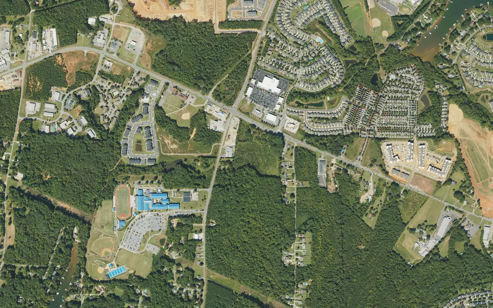
Doolie is the N.C. 150 corridor west of I-77 around Lake Norman High, ZIP code 28117, zoned for Lakeshore Elementary and Middle and Lake Norman High.
Last checked Oct. 11, 2026. Sources: OpenStreetMap place names and store listings, the Town of Mooresville’s Mooresville Tomorrow 2040 plan, Iredell-Statesville Schools’ zone finder, the N.C. Department of Public Instruction’s 2025-26 accountability data, the U.S. Census Bureau’s geocoder and Zillow Research.
Doolie is the stretch of River Highway (N.C. 150) west of I-77 where Doolie Road comes in. OpenStreetMap marks it as a named place, and Lake Norman High School sits on Doolie Road. Shopping centers line the highway, and subdivisions run north and south of it toward Lake Norman. The town’s comprehensive plan names N.C. 150 as one of the corridors where aging shopping centers could be rebuilt as walkable, mixed-use centers. It is in ZIP code 28117.
What this means for you
- Zoned high school: Lake Norman High, 68.1% of tests at grade level in 2025-26. Check an address with the Iredell-Statesville zone finder.
- Home value: $631,168 in ZIP code 28117 in August 2026, according to the Zillow Home Value Index.
- Nearest I-77 exit: Exit 36 at N.C. 150, about 2.4 miles by road.
Part of our Mooresville neighborhoods guide.
Where it is
This guide covers N.C. 150 from the shopping centers just west of Exit 36 out past Doolie Road, and the neighborhoods off it on both sides, including the streets around Robinson Road and Yeager Road. Lake Norman’s shore is to the northeast and west; farther west, N.C. 150 reaches the lake and Catawba County. To the south is Williamson Road.
Town or county? It is mixed. Points on River Highway, Robin Aubrey Lane, Robinson Road and East Morehouse Avenue were inside the Town of Mooresville on the Census Bureau’s geocoder; points on Doolie Road, Yeager Road and Asbury Circle were in unincorporated Iredell County. Check a parcel in Iredell County’s Online Tax Services and see our property tax guide.
Schools
Doolie is in Iredell-Statesville Schools, not the Mooresville Graded School District. Scores are the share of state tests at grade level or above in 2025-26, from the state’s accountability data.
| Level | School | 2025-26 at grade level | Growth |
|---|---|---|---|
| Elementary | Lakeshore Elementary, 252 Lakeshore School Road | 67.6% | Met |
| Middle | Lakeshore Middle, 244 Lakeshore School Drive | 57.7% | Exceeded |
| High | Lake Norman High, 186 Doolie Road | 68.1% | Met |
Lake Norman High’s four-year graduation rate was above 95%, the state reports. In the district’s zone finder, six of our seven points were zoned for the three schools above. The westernmost, on Asbury Circle, was zoned for Woodland Heights Elementary and Middle, with Lake Norman High. More in our schools guide.
Home values
Zillow publishes no figure for Doolie. The Zillow Home Value Index for its ZIP code is a modeled typical value for the middle third of homes, not a sale price.
| Area | August 2026 | August 2025 | Change |
|---|---|---|---|
| ZIP code 28117 | $631,168 | $631,349 | 0.0% |
| Town of Mooresville, for comparison | $478,099 | $479,383 | -0.3% |
The ZIP code also covers lakefront homes on the Brawley School Road peninsula, so it is a broad guide here. Trends are on our home prices page.
Parks and trails
From OpenStreetMap:
- McCrary Creek Access Area, 1437 River Highway, and Pinnacle Access Area, 1556 River Highway, west on N.C. 150 at the lake.
- Stumpy Creek Park, north of the area.
- Cornelius Road Park, 247 Cornelius Road, east of I-77: 79 acres with a dog park, disc golf, tennis and pickleball and a 1-mile walking trail, from the town’s parks list.
More in our parks and trails guide.
Getting around
- I-77: Exit 36 at N.C. 150 is about 2.4 miles by road; Exit 35 at Brawley School Road is about 3.2 miles.
- Downtown Mooresville: about 5.8 miles by road.
- Charlotte Douglas International Airport: about 35 miles by road.
- Road work: NCDOT is widening N.C. 150 from Catawba County to U.S. 21 and rebuilding the Exit 36 interchange with a wider bridge; expect night lane closures. Details are in our road construction guide.
- Buses: the ICATS Mooresville Main route’s stop list includes shopping-center stops such as the Target shopping center and Best Buy; call ICATS at 704-873-9393 to find the nearest. Fares are $1.
Distances were measured with the OSRM routing engine on OpenStreetMap roads from River Highway at Doolie Road. They are distances, not drive times.
Groceries and everyday stores
From OpenStreetMap, all on or just off N.C. 150: Harris Teeter, 118 Argus Lane; Food Lion, 516 River Highway; Walgreens, 542 River Highway; CVS Pharmacy, 559 River Highway; and Sam’s Club, with a pharmacy, at 646 River Highway.
Frequently asked questions
Where is Doolie in Mooresville?
On River Highway (N.C. 150) west of I-77, where Doolie Road meets it. OpenStreetMap marks Doolie as a named place there, and Lake Norman High School is at 186 Doolie Road.
What schools serve the Doolie area?
Iredell-Statesville Schools. Six of the seven points we checked were zoned for Lakeshore Elementary, Lakeshore Middle and Lake Norman High; one point on the west side was zoned for the Woodland Heights schools instead.
Is N.C. 150 in Mooresville being widened?
Yes. NCDOT is widening N.C. 150 from Catawba County to U.S. 21 and rebuilding the I-77 interchange at Exit 36. Our road construction guide tracks the work.
Is Doolie a good place to live?
Here are the facts: it is a mix of shopping centers on N.C. 150 and subdivisions toward Lake Norman, about 2.4 miles by road from Exit 36, zoned for Lake Norman High, where 68.1% of state tests were at grade level in 2025-26. The typical value in ZIP code 28117 was $631,168 in August 2026, Zillow says.
Have your say