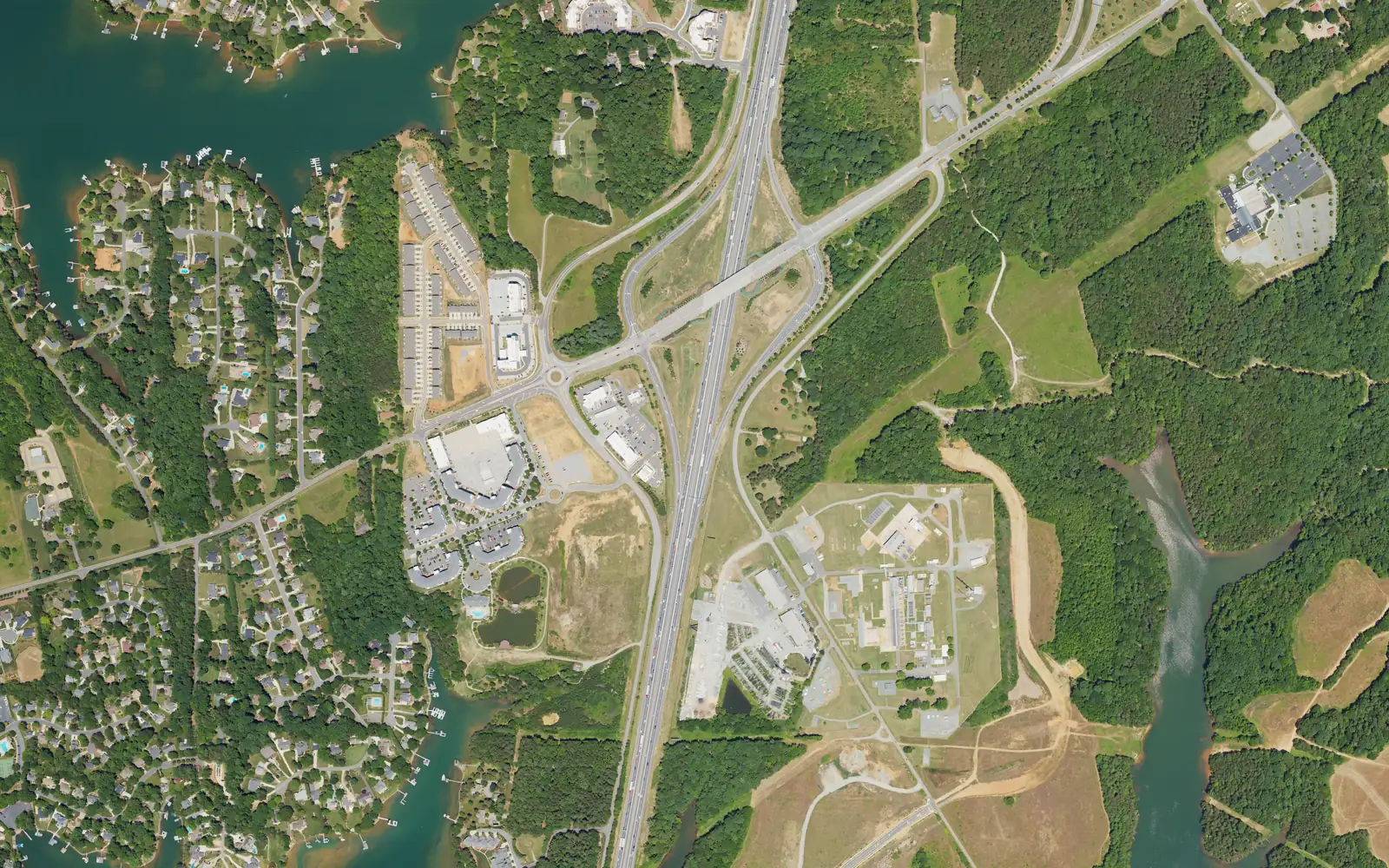
Langtree is south Mooresville at I-77 Exit 31, in ZIP codes 28117 and 28115, zoned for Coddle Creek Elementary, Woodland Heights Middle and Lake Norman High.
Last checked Oct. 11, 2026. Sources: OpenStreetMap place names, exits and store listings, the Town of Mooresville’s Mooresville Tomorrow 2040 plan, Iredell-Statesville Schools’ zone finder, the N.C. Department of Public Instruction’s 2025-26 accountability data, the U.S. Census Bureau’s geocoder and Zillow Research.
Langtree is the south end of Mooresville at I-77 Exit 31, where Langtree Road crosses the interstate. OpenStreetMap marks it as a named place just west of the interchange, between the interstate and Lake Norman’s coves. The town’s comprehensive plan says the town and its partners are building a new east-west connector that starts at Langtree Road on the west and runs to N.C. 115, Shearers Road and N.C. 3, which the plan says “will unlock future development potential in southern Mooresville.” The area straddles ZIP codes 28117 and 28115.
What this means for you
- Zoned high school: Lake Norman High, 68.1% of tests at grade level in 2025-26. Check an address with the Iredell-Statesville zone finder.
- Home value: $631,168 in ZIP code 28117 and $402,878 in ZIP code 28115 in August 2026, according to the Zillow Home Value Index.
- Nearest I-77 exit: Exit 31 at Langtree Road, less than half a mile by road.
Part of our Mooresville neighborhoods guide.
Where it is
This guide covers the land around Exit 31: the buildings beside the interchange, the lakeside neighborhoods west of it around Bridgeport Drive, and Langtree Road and Transco Road east of I-77. Davidson is to the south, and Mount Mourne is to the northeast on N.C. 115.
Town or county? It is mixed. A point on Village View Drive by the interchange was inside the Town of Mooresville on the Census Bureau’s geocoder, in ZIP code 28117. Points on Bridgeport Drive (28117), on Langtree Road east of I-77 (28117) and on Transco Road (28115) were in unincorporated Iredell County. Check a parcel in Iredell County’s Online Tax Services and see our property tax guide.
Schools
Langtree is in Iredell-Statesville Schools, not the Mooresville Graded School District. All five points we checked in the district’s zone finder were zoned for the same three schools. Scores are the share of state tests at grade level or above in 2025-26, from the state’s accountability data.
| Level | School | 2025-26 at grade level | Growth |
|---|---|---|---|
| Elementary | Coddle Creek Elementary, 141 Frank’s Crossing Loop | 68.4% | Not met |
| Middle | Woodland Heights Middle, 272 Forest Lake Blvd. | 70.0% | Exceeded |
| High | Lake Norman High, 186 Doolie Road | 68.1% | Met |
Langtree Charter Academy, 154 Foundation Court, is a public charter school with a Mooresville address in the federal school directory; charter schools admit by application, not by zone. More in our schools guide.
Home values
Zillow publishes no figure for Langtree, and the area is split between two ZIP codes. The Zillow Home Value Index is a modeled typical value for the middle third of homes, not a sale price.
| Area | August 2026 | August 2025 | Change |
|---|---|---|---|
| ZIP code 28117 | $631,168 | $631,349 | 0.0% |
| ZIP code 28115 | $402,878 | $402,907 | 0.0% |
| Town of Mooresville, for comparison | $478,099 | $479,383 | -0.3% |
Trends are on our home prices page.
Parks and trails
The town lists no park inside the area on its parks list. The nearest town fields are the Presbyterian Road fields, 141 Frank’s Crossing Loop, next to Coddle Creek Elementary, with softball and multipurpose fields and a concession stand. OpenStreetMap shows Lake Davidson Nature Preserve just south, in Davidson. More in our parks and trails guide.
Getting around
- I-77: Exit 31 at Langtree Road is less than half a mile by road; Exit 33 at U.S. 21 is about 2.5 miles.
- Downtown Mooresville: about 5.5 miles by road.
- Charlotte Douglas International Airport: about 29 miles by road.
- Buses: the ICATS Mooresville Main’s stop list names no stop here; booked ICATS van trips cost $1, 704-873-9393.
Distances were measured with the OSRM routing engine on OpenStreetMap roads from the interchange’s west side. They are distances, not drive times. More in our getting around guide.
Groceries and everyday stores
OpenStreetMap lists no supermarket or pharmacy inside the area. The nearest are Food Lion, 835 Williamson Road, to the north near Exit 33, and Harris Teeter, 431 Peninsula Drive, to the south near Exit 30.
Frequently asked questions
Where is Langtree in Mooresville?
At the south end of Mooresville, around I-77 Exit 31 and Langtree Road. OpenStreetMap marks Langtree as a named place just west of the interchange.
What schools serve Langtree?
Iredell-Statesville Schools. All five points we checked were zoned for Coddle Creek Elementary, Woodland Heights Middle and Lake Norman High.
Is Langtree in Mooresville town limits?
Partly. A point by the interchange on Village View Drive was inside the town on the Census Bureau’s geocoder; points on Transco Road, Bridgeport Drive and Langtree Road east of I-77 were in unincorporated Iredell County.
How far is Langtree from Charlotte Douglas airport?
About 29 miles by road, the shortest airport trip of any Mooresville area in our guide. Exit 31 is less than half a mile away. Those are distances, not drive times.
Have your say