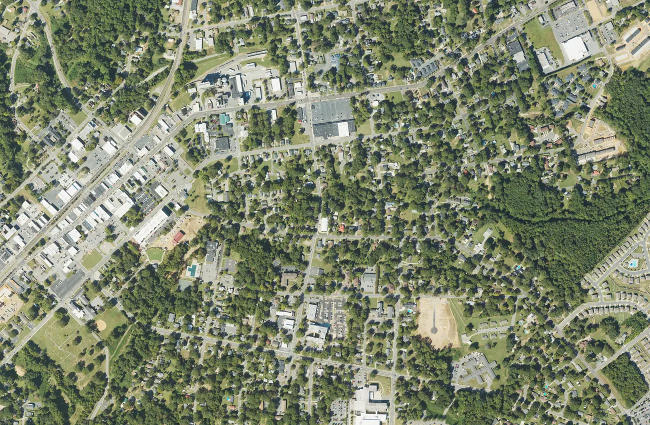
Downtown Mooresville is the old railroad town on Main and Broad streets, ZIP code 28115. It is zoned for Mooresville Graded schools and Mooresville High.
Last checked Oct. 11, 2026. Sources: the Town of Mooresville’s Mooresville Tomorrow 2040 plan and parks list, the National Park Service’s National Register record, the Mooresville Graded School District’s Find My School tool, the N.C. Department of Public Instruction’s 2025-26 accountability data, the U.S. Census Bureau’s geocoder, Zillow Research and OpenStreetMap.
Downtown Mooresville is the railroad town the rest of Mooresville grew around: a few blocks of brick storefronts on Main and Broad streets beside the tracks, with older houses on the grid of streets east and west of them. It is inside the town limits, in ZIP code 28115, and in the Mooresville Graded School District. The town’s comprehensive plan, adopted Sept. 21, 2026, calls it the “historic downtown” and gives it its own activity center category.
What this means for you
- Zoned high school: Mooresville High, 60.3% of tests at grade level in 2025-26. Check an address with Find My School.
- Home value: $402,878 in ZIP code 28115 in August 2026, according to the Zillow Home Value Index.
- Nearest I-77 exit: Exit 36 at N.C. 150, about 3.5 miles by road.
Part of our Mooresville neighborhoods guide.
Where it is
The commercial core is Main Street and Broad Street, on either side of the railroad, with Center Avenue and Iredell Avenue (N.C. 152) crossing it. The Mooresville Historic District, listed on the National Register in 1980 and enlarged in 2020, covers the old commercial center by the depot along N.C. 115 and N.C. 152. South of it is the separately listed Mill Village.
Town or county? Every downtown point we checked against the Census Bureau’s geocoder was inside the Town of Mooresville. Property in the downtown service district pays an extra 14 cents per $100 of value on top of the town, county and school district rates; see our property tax guide.
Schools
All of downtown is in the Mooresville Graded School District, but the zone line splits it. Points on and north of Iredell Avenue came back zoned for one set of schools and points a few blocks south, on Institute Avenue and South Church Street, for another in the district’s Find My School tool. Scores are the share of state tests at grade level or above in 2025-26, from the state’s accountability data; K-2 schools do not take state tests.
| Level | North side | South side |
|---|---|---|
| K-2 | Park View Elementary, 217 W. McNeely Ave. | South Elementary, 839 S. Magnolia St. |
| 3-5 | East Mooresville Intermediate, 68.8% | Mooresville Intermediate, 65.9% |
| 6-8 | Selma Burke Middle, 66.2% | Mooresville Middle, 65.7% |
| 9-12 | Mooresville High, 659 E. Center Ave., 60.3% | Mooresville High |
All five tested schools met their state growth targets. The district’s numbers and calendar are in our schools guide.
Home values
Zillow publishes no figure for downtown alone, so the ZIP code is the closest guide. The Zillow Home Value Index is a modeled typical value for the middle third of homes, not a sale price.
| Area | August 2026 | August 2025 | Change |
|---|---|---|---|
| ZIP code 28115 | $402,878 | $402,907 | 0.0% |
| Town of Mooresville, for comparison | $478,099 | $479,383 | -0.3% |
ZIP code 28115 covers downtown and most of the town east of I-77. Trends are on our home prices page and recorded sales on our real estate transfers page.
Parks and trails
From the town’s parks list:
- Liberty Park, 217 E. Iredell Ave.: 6 acres with a splash pad, basketball, a picnic shelter and a playground. It hosts the town’s free movie nights.
- John Franklin Moore Park, 104 W. Center Ave., at Main Street: benches and the seasonal displays.
- Lee Street Park, 331 Lee St., and Stevenson Street Park, 312 Stevenson St.: half-acre parks with basketball, a shelter and a playground.
- Willow Valley Park, 216 E. McLelland Ave., on OpenStreetMap; the town’s East Center Avenue project adds a walking link to it, due at the end of 2026.
More in our parks and trails guide.
Getting around
- I-77: Exit 36 at N.C. 150 is about 3.5 miles by road; Exit 35 at Brawley School Road is about 4.6 miles.
- Charlotte Douglas International Airport: about 33 miles by road.
- Buses: the ICATS Mooresville Main route’s stop list includes the Mooresville Library and the Charles Mack Citizen Center downtown, with seven runs a day from 8 a.m. Fares are $1 a boarding; call ICATS at 704-873-9393.
- Parking: since Oct. 1, three downtown public lots are closed to parking from 2 to 6 a.m.; details are in our getting around guide.
Distances were measured with the OSRM routing engine on OpenStreetMap roads. They are distances, not drive times.
Groceries and everyday stores
OpenStreetMap lists a CVS Pharmacy on Main Street, Health Smart Pharmacy at 594 N. Main St. and a Save-A-Lot grocery near downtown. The nearest full supermarket chains are Food Lion, 971 N. Main St., and Walmart Neighborhood Market, 966 E. Iredell Ave. For restaurants and shops, see our downtown Mooresville guide.
Frequently asked questions
What school district is downtown Mooresville in?
The Mooresville Graded School District. Every downtown point we checked in the district’s Find My School tool was zoned for Mooresville High, with Park View Elementary on the north side and South Elementary on the south side.
What ZIP code is downtown Mooresville?
- Zillow’s typical home value for that ZIP code was $402,878 in August 2026, a modeled estimate, not a sale price.
Is downtown Mooresville a historic district?
Yes. The Mooresville Historic District, along N.C. 115 and N.C. 152 by the depot, has been on the National Register of Historic Places since 1980 and was enlarged in 2020.
How far is downtown Mooresville from I-77?
About 3.5 miles by road to Exit 36 at N.C. 150, and about 33 miles by road to Charlotte Douglas International Airport. Those are distances, not drive times.
Have your say